 Barrett Community Portal
Heart of the Poconos
Local News
Shared Housing And Resource Exchange (SHARE)
DO YOU HAVE EXTRA SPACE IN YOUR HOME?
WOULD YOU LIKE SOME COMPANIONSHIP?
EXTRA INCOME ?
If you answered “yes” to these questions, the SHARE program may be just what you need. SHARE (Shared Housing And Resource Exchange) is a new housing program being offered in Monroe, Pike and Wayne Counties. Professional Housing Counselors screen and match people who have extra space in their homes with people seeking an affordable living situation.
If this sounds like a good idea for you or someone you know, please contact:
Monroe County
Ryan Lohman
570-832-0538
Pending Arbitration between Barrett Supervisors and PMRPD
To Whom it May Concern:
From the Barrett Township Supervisor Meeting Minutes from the February 15, 2018 Meeting (after returning from executive session)
Quote:
William Pipolo, Jr. made a motion to hire Attorney Jerome Cheslock to become the Arbitrator to resolve the differences with the Organization Agreement with Pocono Mountain Regional Police Department.* The motion was seconded by Patti O'Keefe and carried. All Supervisors voted aye.
(*emphasis added)
Upon asking the Supervisors for further information on the issue at the February 28 Supervisor Meeting, the response was that they could not discuss the issue because it is pending litigation.
Animal tracking for young outdoors explorers
IF YOU GO: Animal tracking
WHEN: 10:30 a.m. to noon Saturday, Feb. 24
WHERE: Kettle Creek Environmental Education Center, 8050 Running Valley Road, Bartonsville
COST: Free, but registration is required.
DETAILS: This activity is suitable for children of all ages. Children and adults should dress to be outside and be prepared to walk on snow-covered trails.
On Saturday, Feb. 24, children and their parents will have the opportunity to get outside and learn about the tracks and traces that our native wildlife leave behind.
The program “Who Goes There? Tracking Pocono Wildlife,” led by an experienced environmental educator, starts inside as children and their families learn about critters who live in the woods and along the cold, pure streams of the Poconos. How animals make tracks and what to look for in identifying tracks will be covered.
From Service Station to Garden Center
Barrett Township Historical Society presents:
From Service Station to Garden Center
by Elaine Bubb, Owner, Stonewall Garden Center
Date: Friday, February 16
Time: 2pm
Location: The Friendly Community Center
LSA Grant - Renovations to the Barrett Fire house (2018)
Barrett Township has been awarded an LSA Grant for $148,270 for the Firehouse Renovations Project. The renovations include: Roof, Painting, Meeting Rooms Flooring, Engine Room Flooring, Folding Door (Meeting room), Furnace, AC, Overhead Doors, Sound Blocks and Doors. Work is anticipated to start Summer 2018
The Barrett Township Volunteer Fire Company is vital. "Their firehouse here is the hub of all the activity," says Pam Gardsy, Barrett Township's Executive Secretary Treasurer.
But the building is falling apart.
Gardsy adds, "it's very dated."
Thanks to a $148,000 dollar grant, the firehouse's floors, roof, and heating system will be repaired.
Event: Women Who Made History in Monroe County (1/19/2018)
Barrett Township Historical Society
General Membership Meeting
January 19, 2018
Short business meeting begins at 2:00pm, followed by speaker Amy Leiser, Director of Monroe County Historical Association, presenting Women Who Made History in Monroe County
All at the Friendly Community Center on Route 191 (across from the MUMC Church at the 390/191 split)
All Welcome. Refreshments. Free.
Contact:
Donna Bisset
570-595-2857
2018 Reorganization Meeting: January 2, 2018
The Supervisors' reorganization meeting will be held on January 2, 2018 at 9am.
This will be the first day in office for new candidates Grant Hilfiger and Patti O'Keefe.
Pennsylvania Gambling Act Amendments Affect Mount Airy Casino
On October 30, 2017, Pennsylvania Governor Tom Wolf signed House Bill 271 into law as Act 42. The law amends the Pennsylvania Race Horse Development and Gaming Act. Among the amendments, Act 42 authorizes interactive gaming (“iGaming”), video gaming terminals (“VGTs”) at truck stops, internet lottery (“iLottery”), tablet gaming at airports, fantasy sports contests, and ancillary slot machine facilities. (source)
Related to the Mount Airy Casino, the law also recently granted a larger buffer zone, where no other casinos can open in a county contiguous to Mount Airy (Pike, Wayne, Carbon, Lackawanna, Northampton). (source)
This gives Mount Airy Casino, a Category 2 casino, the ability to bid on Category 4 "Ancillary" licenses, meaning they could set up slot machines and other types of gambling on properties in Pike, Wayne, Carbon, Lackawanna, and Northampton counties. In Barrett, specifically, this means they could set up slot machines at Buck Hill Falls or Skytop.
Monroe County Dispatch Center Software Upgrade - Cost Overrun
The 911 Center in Monroe County is in the process of installing a new computer system to help with dispatch. Called the "CAD Project" (Computer Aided Dispatch), it was announced at the Supervisor meeting on November 22, 2017, that the roll-out of the system has been delayed and additional time and money will be required to complete implementation.
It is curious that Tyler Technology is behind the CAD Project roll-out, as well as the overall property reassessment which as been delayed as well.
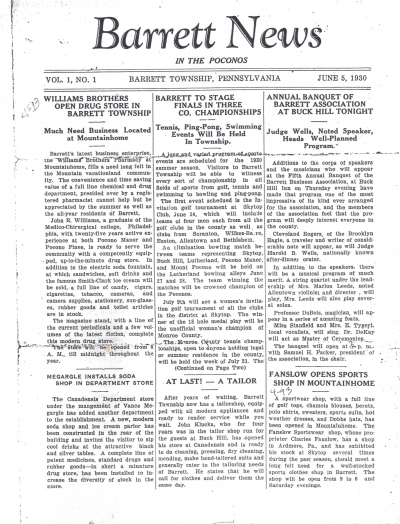
Flashback! 1930 Barrett News, Volume 1
This is a neat little gem from Barrett Township in 1930. See 'attachments' area below to download the PDF.
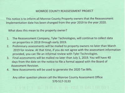
Monroe County Reassessment: DELAYED (!?)
**Update 2/16/18
- Tyler Technologies is now advertising "Data Collectors Needed for Reassessment Project"
** Original Post:
Fellow residents,
You may have recently received a green postcard in the mail regarding the Monroe County 2019 reassessment (see image). Full text is as follows:
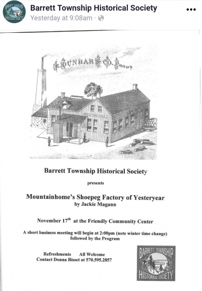
Mountainhome's Shoepeg Factory of Yesteryear
Barrett Township Historical Society presents -
Mountainhome's Shoepeg Factory of Yesteryear
by Jackie Magann
November 17th at the Friendly Community Center
A short business meeting will begin at 2:00pm (note winter time change) followed by the Program.
Refreshments - All are Welcome
Contact Donna Bisset at 570.595.2857


