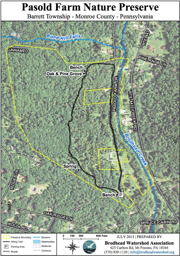
From the first parking lot, go up to the kiosk (Andrew Price’s Eagle Scout project) to vie the map created by the Monroe County Planning Commission. Head up the hill between the pines, following the Blue Trail markers, and continue to the top of the ledge. There is an intermittent stream which often makes this part of the trail wet. You can see where water runs off the hillside from an old spring house. Continue along the trail and notice the wide variety of trees, including a Black Gum (Tupelo) at the fringe of its range. Part of the trail crosses old stone rows, indicating that this area was indeed a farm. As you continue, notice the ledge of bedrock scoured by the last glacier. On you left you may spy a large, multi-trunked pine which met with an equally old oak, and grew together. As you near the end, the trail heads downhill, ending at the road. Here you can scramble down to the rock ledges along the Creek, dip your fingers in and feel the chill of the water, but please no swimming. A short walk along the Creek brings you back to the parking area.
The Brodhead is renowned as a trout stream, but a PA license is required. This property was purchased solely with grant money, from the Monroe County Open Space Bond and PA Keystone grant.


